April 3
We’ll, no WiFi yesterday, so just posted yesterday’s blog. Apologies if you get two posts today. And, a heads up, I don’t think I’ll have WiFi tomorrow. Now, how Third World is that.
Today was a great day. Beautiful weather. Day breaks Down into two elements. The scenery is spectacular. There’s an amazing view around every turn. Impossible to catch it in photos, but here’s a feeble try.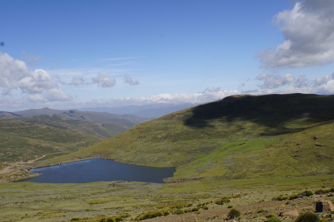 
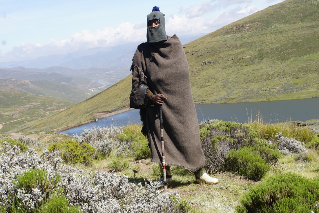
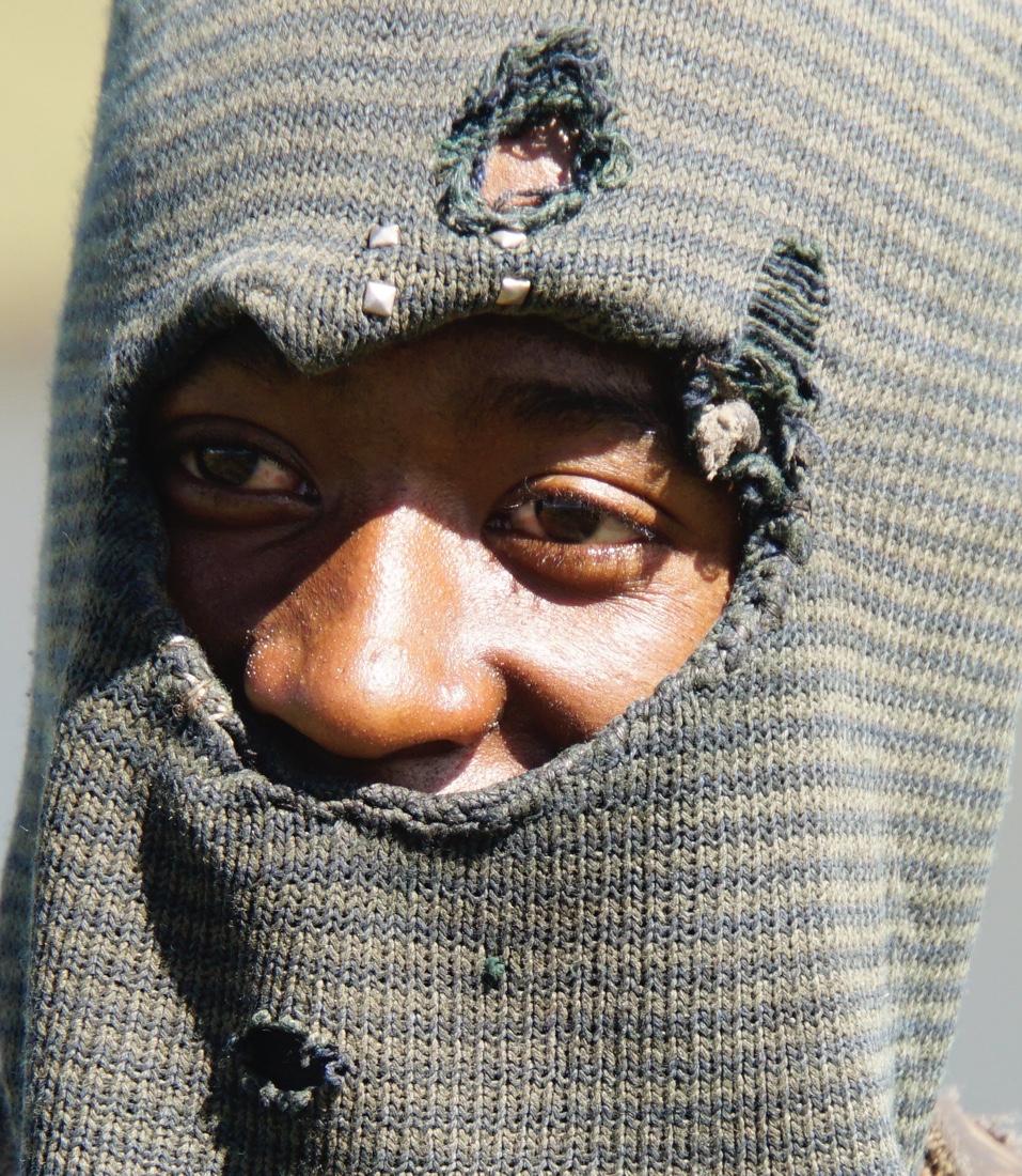
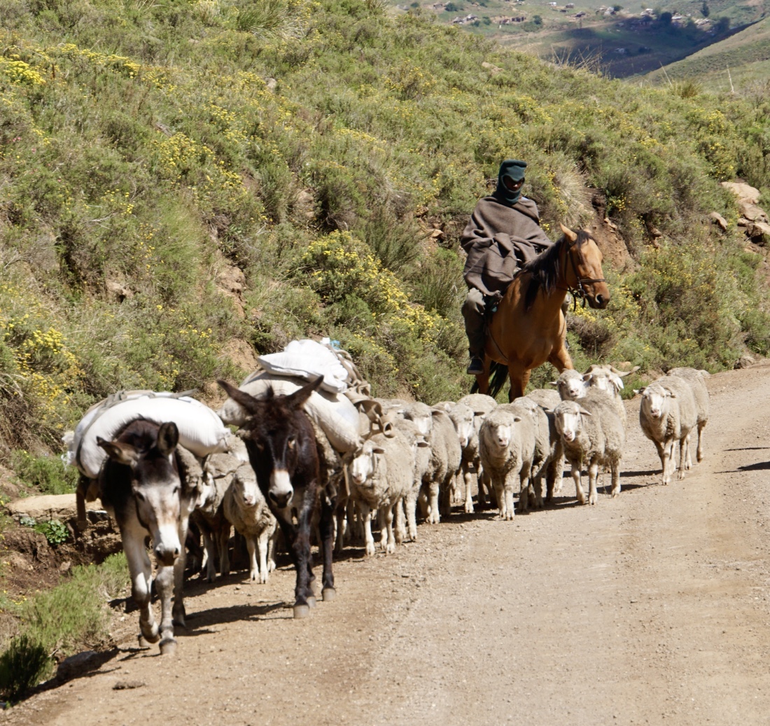
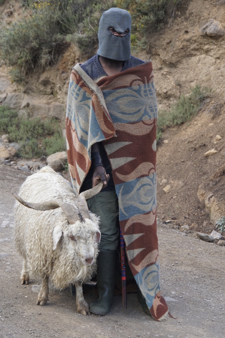
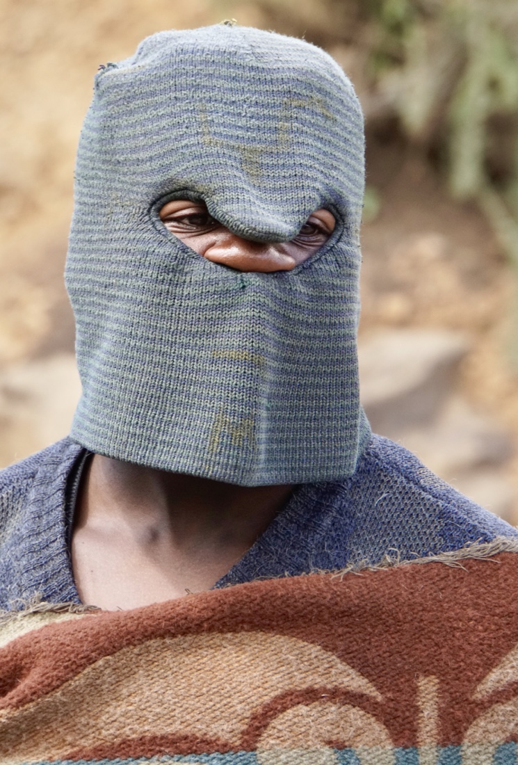
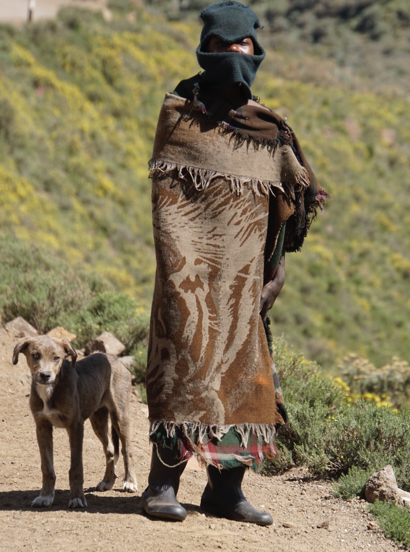
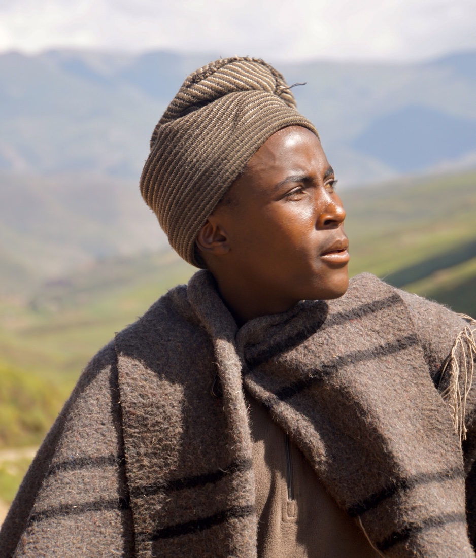
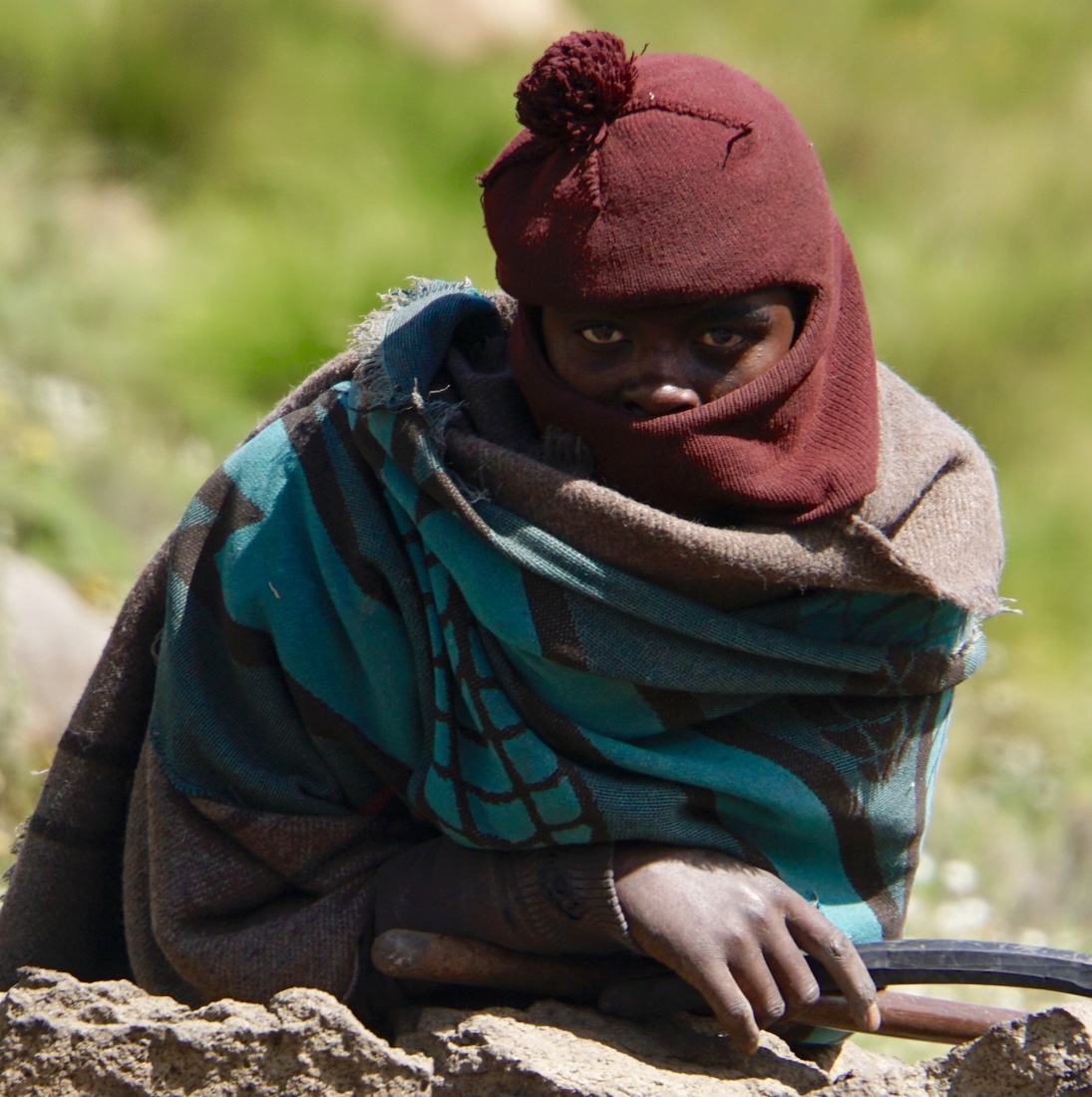
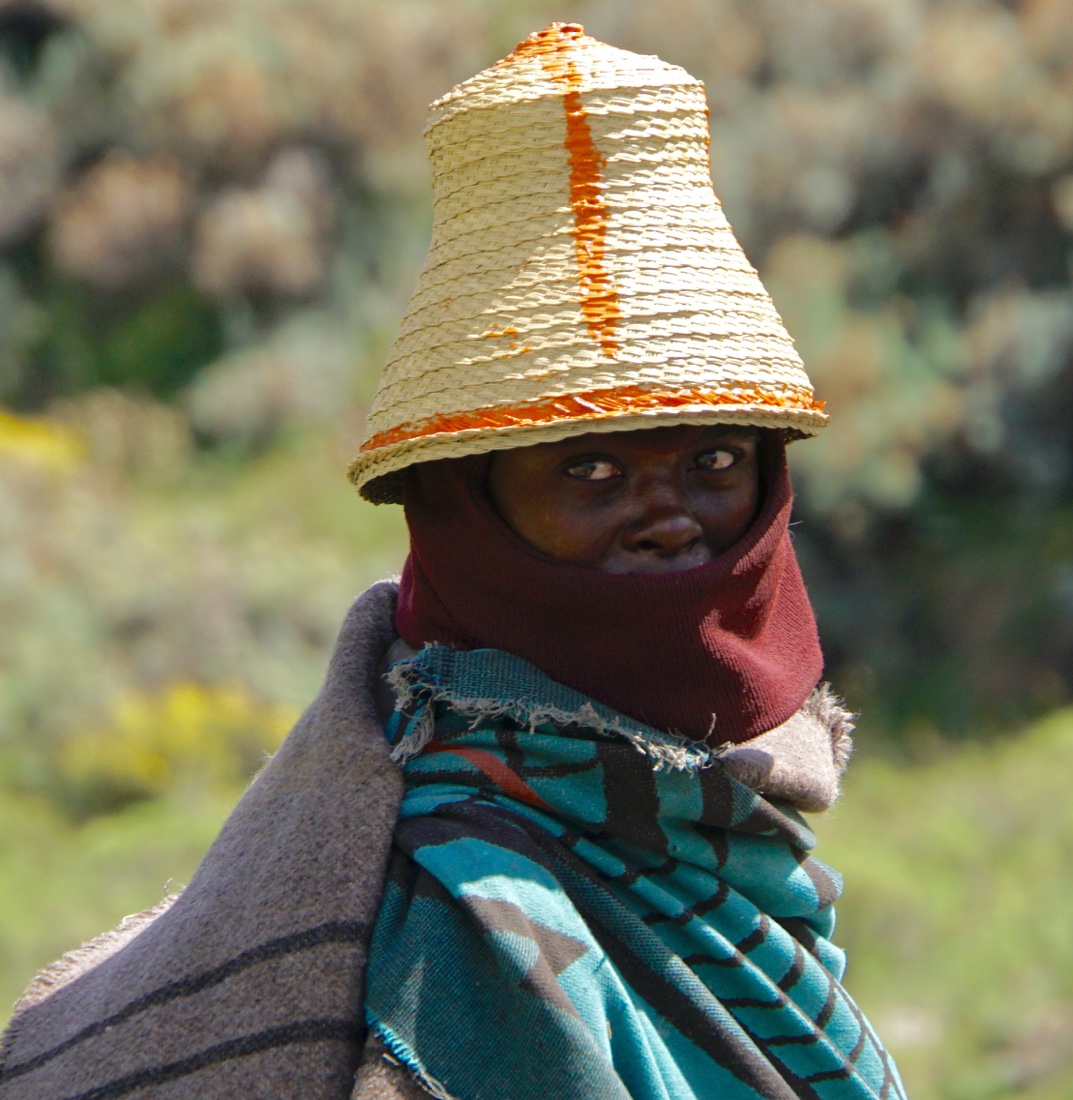
  The shepherds ordinarily would not want to be photographed, but our guides speak to them, tell them we’ll pay them something (small) and they readily agree. In fact, enthusiastically, with much laughing and smiling. The life of a shepherd is not an easy one. In fact, it sucks. Live in a hut in the country for four or five months, bringing all your food (generally the same meal each day), chase after sheep, or goats all day, and get up the next day and do it all over again. I’ve decided against shepherding for my next career. The shepherds ordinarily would not want to be photographed, but our guides speak to them, tell them we’ll pay them something (small) and they readily agree. In fact, enthusiastically, with much laughing and smiling. The life of a shepherd is not an easy one. In fact, it sucks. Live in a hut in the country for four or five months, bringing all your food (generally the same meal each day), chase after sheep, or goats all day, and get up the next day and do it all over again. I’ve decided against shepherding for my next career.
Here are what may seem like a lot of photos of shepherds, but it’s not easy picking among 300 or so.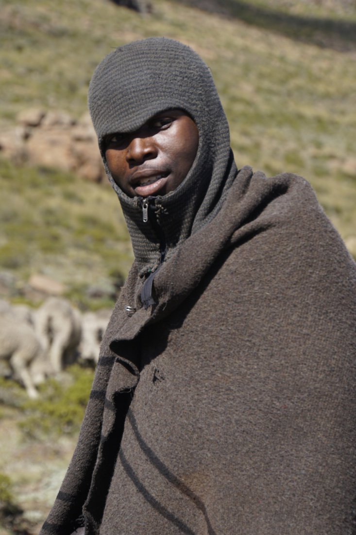 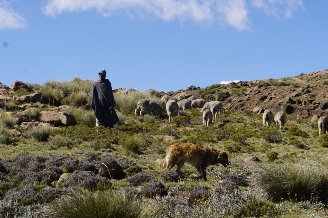
          We watched the sheep being “dipped” to protect against disease. My stills pale by comparison to Stan Begley’s video, so take a look at that.http://dualartspress.com/wp-content/uploads/2019/04/medium-2.mov We watched the sheep being “dipped” to protect against disease. My stills pale by comparison to Stan Begley’s video, so take a look at that.http://dualartspress.com/wp-content/uploads/2019/04/medium-2.mov
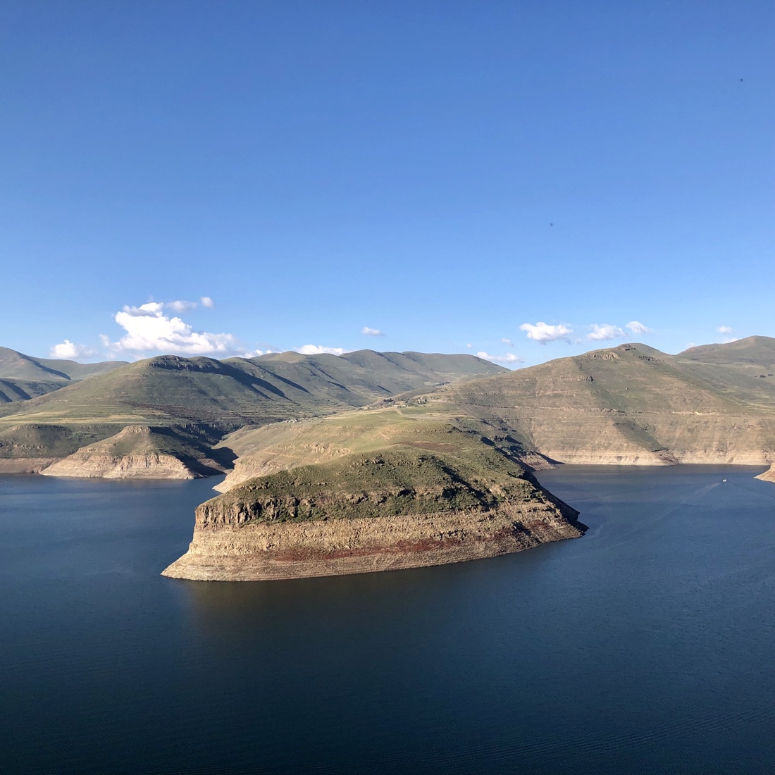
We travel over the Pass of Guns and pass the Kao Mines (a working diamond mine but we are not permitted to enter) and continue to the Katse Dam, a concrete arch dam on the Malibamat’so River in Lesotho, which is Africa’s second largest double-curvature arch dam. (The Tekezé Dam, completed in early 2009, is now Africa’s largest double curvature dam). The dam is part of the Lesotho Highlands Water Project, which will eventually include five large dams in remote rural areas. The potential of the project was identified by the South African civil engineer Ninham Shand (now Aurecon) as a possible means to supplement the water supply to South Africa. The World Bank arranged for a treaty between the governments of South Africa and Lesotho, allowing execution of the project to proceed
Staying at an ordinary, but just fine, hotel, where we had a very good dinner. More Lethoso tomorrow, though you will not hear from me for a couple days, because of lack of WiFi tomorrow.
April 2
After breakfast we will drive about 3-4 hours to the border of Lesotho. On the way, we stop for some photos of the great scenery (which, unfortunately I can’t post, because I accidentally deleted them). We have lunch in Clarens, a cute, but touristy town, before meeting, Frank and Lungelo the Sani Pass Tour guides, who will be our guides in Lesotho ( pronounced as if it were written ” l’shoo-too”). After border formalities which are about like going from the US to Canada by car, we drive about two hours to our hotel.
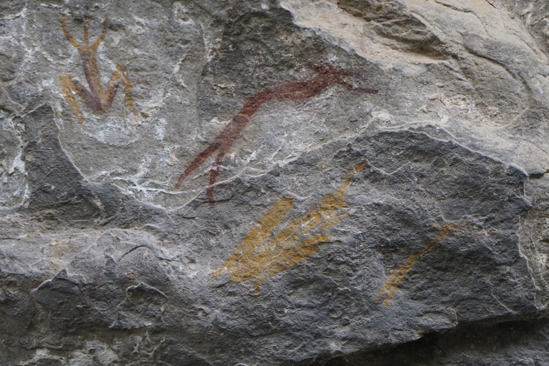
On the way, we stop at Liphofung Caves to see Bushmans rock art. The Liphofung “place of the eland” Caves occupy an important place in Lesotho history. This is the smallest of the Lesotho Highlands Development Authority. The cave is in fact a large sandstone overhang, which is a typical feature of the Lesotho lowlands region. Originally used by the San and other Stone Age people, the walls contain important rock art and a rich archaeological deposit of Stone Age implements. Later, King Moshoeshoe “the Great” used the cave as a stopover when visiting that part of the kingdom. The road to the caves is largely paved and there are railings in most places, so that the walk is quite doable. The altitude (we’re at 6000 feet) does leave me a bit short of breath.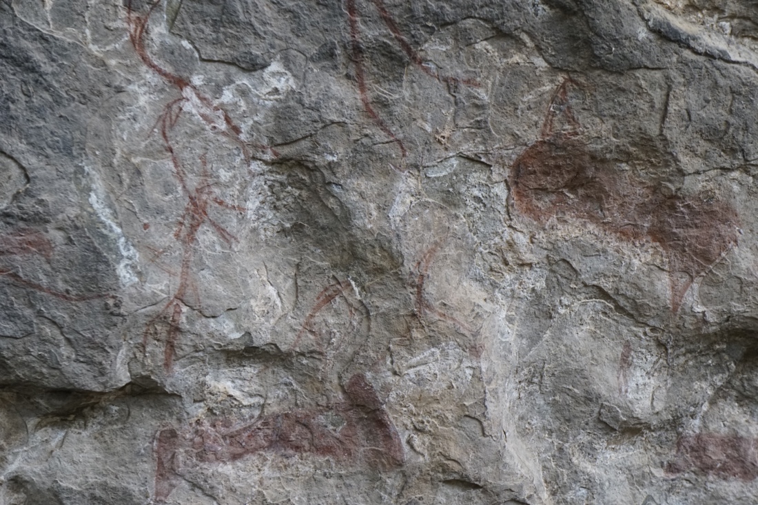 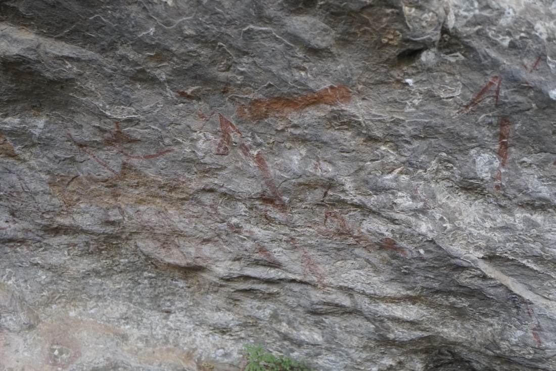
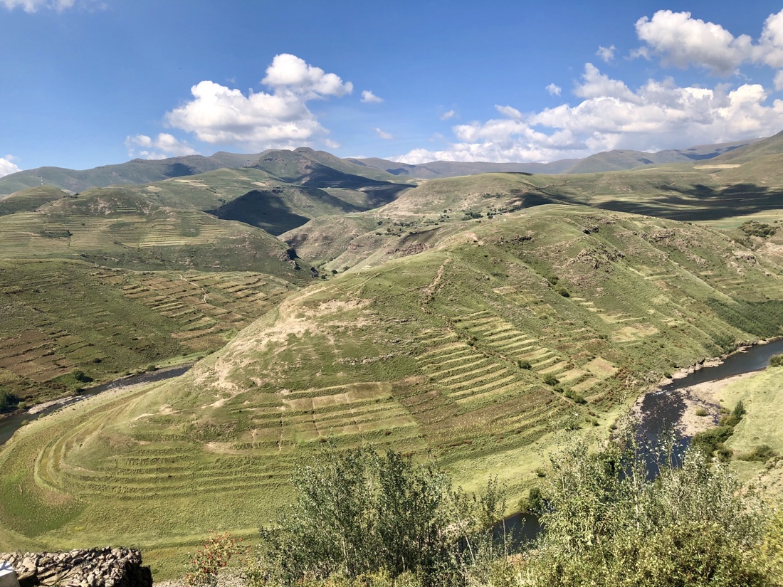
 We continue on through the scenic highlands. This is where the Maluti Mountains start and this magnificent range is the home of the Oxbow part of the Butha-Buthe region of Lesotho. The area experiences its coldest time during the winter months of July and August and even has a small skiing area. I’m not much on landscape photography, but here’s an attempt to give you some idea of what we see. We continue on through the scenic highlands. This is where the Maluti Mountains start and this magnificent range is the home of the Oxbow part of the Butha-Buthe region of Lesotho. The area experiences its coldest time during the winter months of July and August and even has a small skiing area. I’m not much on landscape photography, but here’s an attempt to give you some idea of what we see.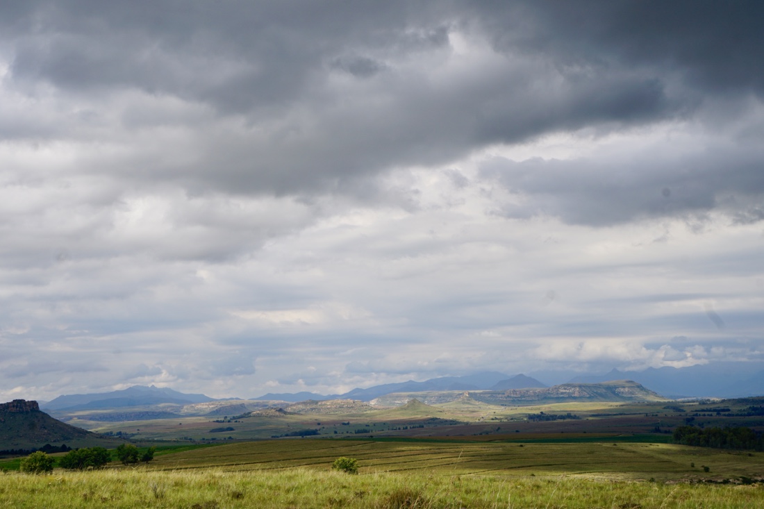 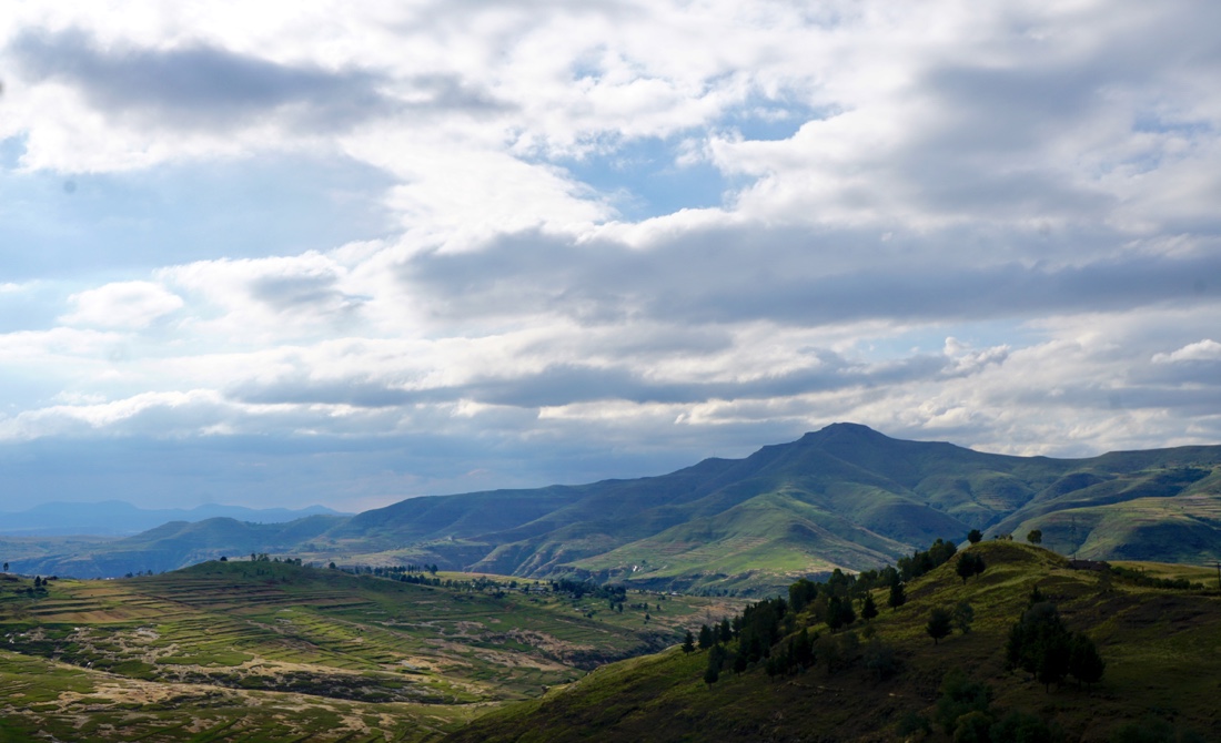 
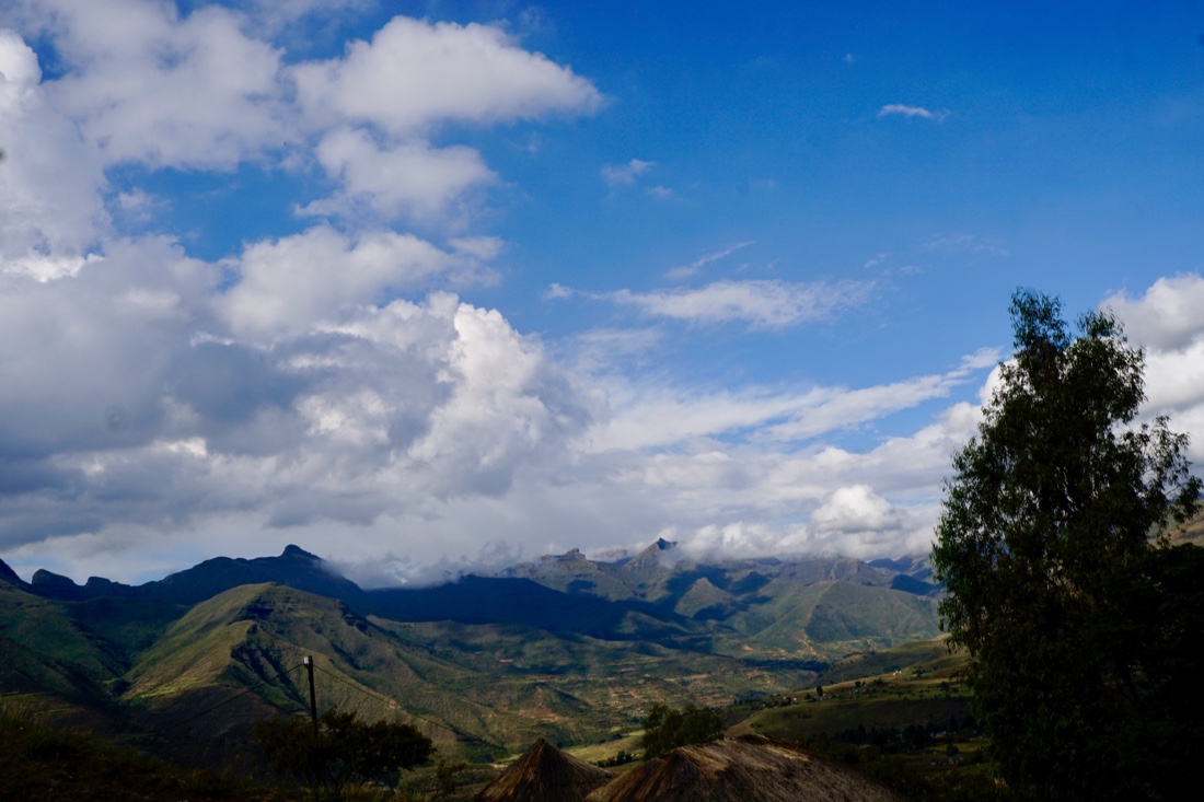 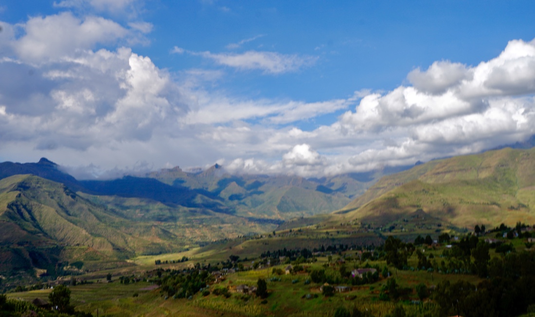 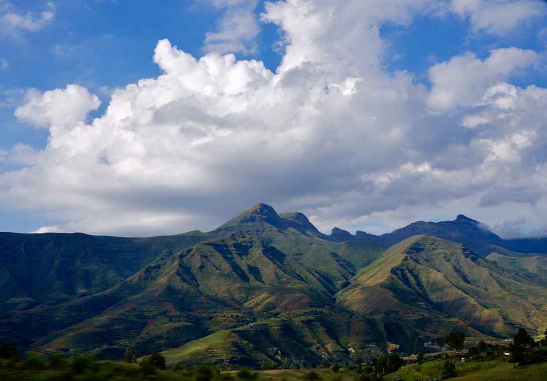 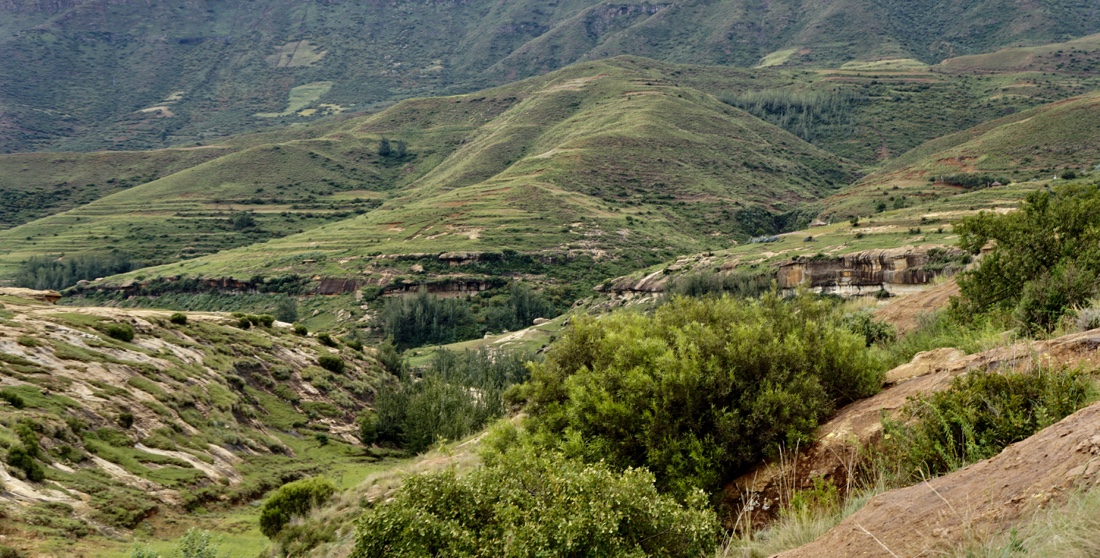 Here are a few other scenes we see along the way. Here are a few other scenes we see along the way.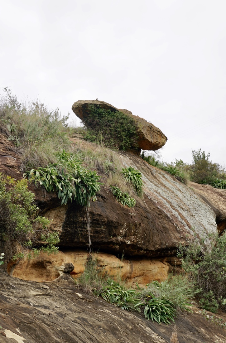 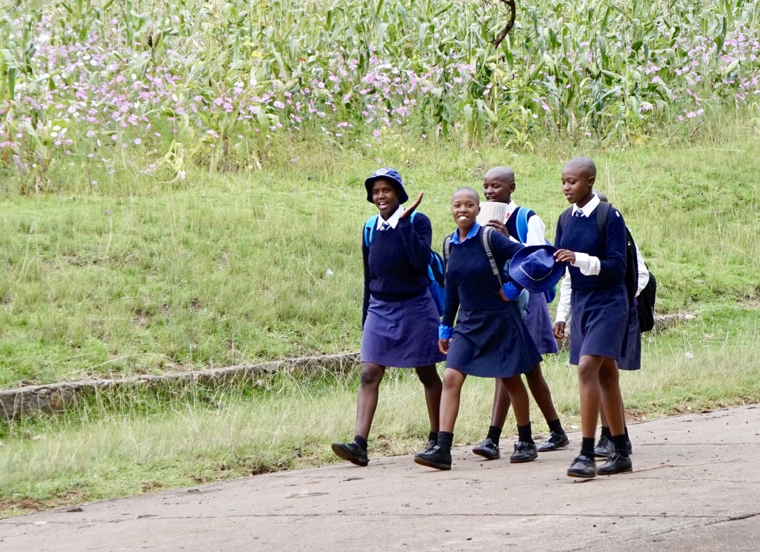 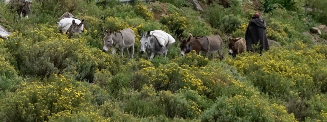 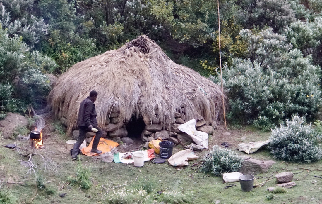 Lesotho, known as the Mountain Kingdom or Kingdom in the Sky, holds a wealth of different experiences in store for those who visit there. Mountains, valleys and rivers present unforgettable panoramas for visitors. Lesotho, known as the Mountain Kingdom or Kingdom in the Sky, holds a wealth of different experiences in store for those who visit there. Mountains, valleys and rivers present unforgettable panoramas for visitors.
The mountains are the source of Lesotho’s crystal-clear water, which also waters the green pastures for livestock. Diamonds are among the minerals found in the mountains. Indeed, Lesotho can truly be called the Kingdom in the Sky.
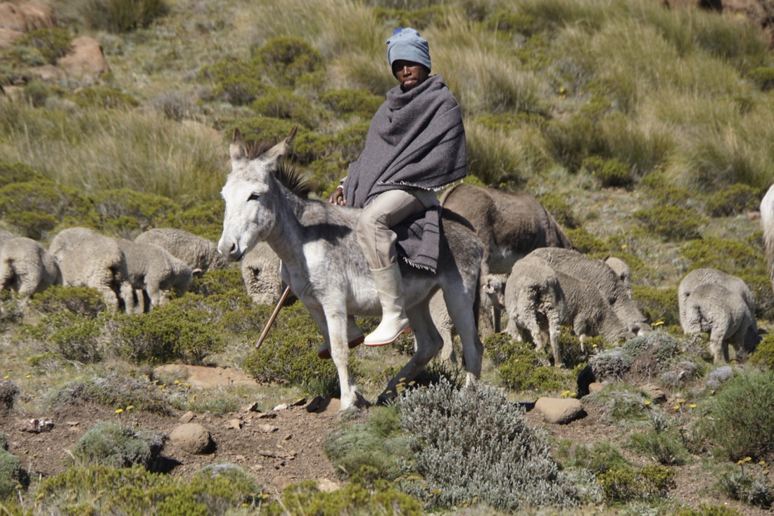
The Basotho are a Bantu ethnic group whose ancestors have lived in southern Africa since around the fifth century. The Basotho nation emerged from the accomplished diplomacy of Moshoeshoe I (pronounced mo-SHWAY-shway), who gathered together disparate clans of Sotho–Tswana origin that had dispersed across southern Africa in the early 19th century. Most Basotho today live in South Africa, as the area of the Orange Free State was originally part of Moshoeshoe’s nation (now Lesotho). Both men and women invariably wear the wool Basotho blanket as a cloak, regardless of the season. The careful selection of color and pattern allows for individual expression.
Everywhere in Lesotho, one sees the small, sturdy Sotho pony, adept at negotiating the steep mountains and gullies and indispensable for carrying the grain to the mill for grinding. The nation’s flag, adopted in 1987, has diagonal stripes of white, blue, and green. White is symbolic for peace (khotso), blue for rain ( pula ), and green for plenty ( nala ). A shield that is part of the country’s coat of arms appears in the upper left diagonal space. The national anthem is “Lesotho, Land of our Fathers” (Lesotho fatse la bontat’a rona).
LETHOSO HISTORY
For those of you interested in Lethoso history, try this.
The history of people living in the area now known as Lesotho goes back as many as 40,000 years. The present Lesotho (then called Basutoland) emerged as a single polity under paramount chief Moshoeshoe I (pronounced mo-SCHWAY-SCHWAY) in 1822. Under Moshoeshoe I, Basutoland joined other tribes in their struggle against the Lifaqane associated with the reign of Shaka Zulu from 1818 to 1828.
Subsequent evolution of the state was shaped by contact with the British and Dutch colonists from Cape Colony. Missionaries invited by Moshoeshoe I developed orthography and printed works in the Sotho language between 1837 and 1855. The country set up diplomatic channels and acquired guns for use against the encroaching Europeans and the Korana people. Territorial conflicts with both British and Boer settlers arose periodically, including Moshoeshoe’s notable victory over the Boers in the Free State–Basotho War, but the final war in 1867 with an appeal to Queen Victoria, who agreed to make Basutoland a British suzerainty. In 1869, the British signed a treaty at Aliwal with the Boers that defined the boundaries of Basutoland and later Lesotho, which by ceding the western territories effectively reduced Moshoeshoe’s kingdom to half its previous size.
The extent to which the British exerted direct control over Basutoland waxed and waned until Basutoland’s independence in 1966, when it became the Kingdom of Lesotho. However, when the ruling Basotho National Party (BNP) lost the first post-independence general elections to the Basotho Congress Party (BCP), Leabua Jonathan refused to cede and declared himself Tona Kholo (Sesotho translation of prime minister). The BCP began an insurrection that culminated in a January 1986 military coup forced the BNP out of office. Power was transferred to King Moshoeshoe II, until then a ceremonial monarch, but forced into exile when he lost favour with the military the following year. His son was installed as King Letsie III. Conditions remained tumultuous, including an August 1994 self-coup by Letsie III, until 1998 when the Lesotho Congress for Democracy (LCD) came to power in elections which were deemed fair by international observers. Despite protests from opposition parties, the country has remained relatively stable since.
.
A chronology of key events:
1820s – Basutoland founded by Moshoeshoe, who unites various groups to repel challenges from Zulus.
1834 – Territorial encroachment by Boer trekkers starts decades of conflict.
1860s – Becomes a British protectorate.
1871 – Annexed to the Cape Colony.
1884 – Becomes a British colony after revolt against Cape Colonial rule. Paramount chiefs retain large degree of autonomy.
1939-45 – World War II, with 20,000 Sotho serving in the British forces.
1950s – Political parties emerge, press for independence.
1966 – Independence as Kingdom of Lesotho, with Moshoeshoe II as king and Chief Leabua Jonathan (Basotho National Party) as prime minister.
1970 – Oppostion Basutoland Congress Party leads in polls but Chief Jonathan suspends constitution, sends king into temporary exile.
1986 – South Africa blocks borders, demanding expulsion of anti-apartheid activists. Major-General Justin Lekhanya replaces Chief Jonathan in coup.
1990 – King Moshoeshoe II goes into exile. His son is sworn in as Letsie III.
1991 – General Lekhanya forced out by Colonel Elias Tutsoane Ramaema, who lifts ban on political activity.
1993 – Basutoland Congress Party comes to power in elections.
1994 – Fighting among rival army factions.
1995-1996 – Moshoeshoe II restored to throne, but dies in a car crash. Letsie III restored as king.
1998 – Lesotho Congress of Democrats (LCD) wins general elections, Pakalitha Mosisili becomes prime minister. South African Development Community (SADC) sends troops to help restore order after opposition riots.
2002 June – Prime Minister Mosisili is sworn-in for a second five-year term.
2004 February – Prime Minister Mosisili declares state of emergency, appeals for food aid. Aid officials say
hundreds of thousands face shortages after three-year struggle against drought.
2004 March – Official opening of first phase of multi-billion-dollar Lesotho Highlands Water Project, which supplies water to South Africa.
2007 February – Ruling LCD wins early parliamentary elections, taking 61 of 80 constituencies; leader of the opposition All Basotho Convention (ABC) challenges the outcome.
2007 July – State of emergency declared as Lesotho experiences its most severe drought in 30 years.
2012 May – ABC’s Thomas Thabane becomes prime minister following elections.
2014 August – Prime Minister Thabane flees to South Africa, accusing the military of trying to overthrow him.
2015 February – Pakalitha Mosisili becomes prime minister at the head of a coalition formed after early elections.
2017 June – Prime Minister Mosisili loses early elections, Thomas Thabane returns to power.
2017 September – The head of the armed forces, Khoantle Mots’omots’o, is shot dead. A multinational security force is deployed to ease tensions.
April 1.
After breakfast, we set out for a craft store which carries baskets produced by women in the region. There were a couple of basket makers weaving while were there. The quality of the crafts appeared to be very high and it was worthwhile seeing it.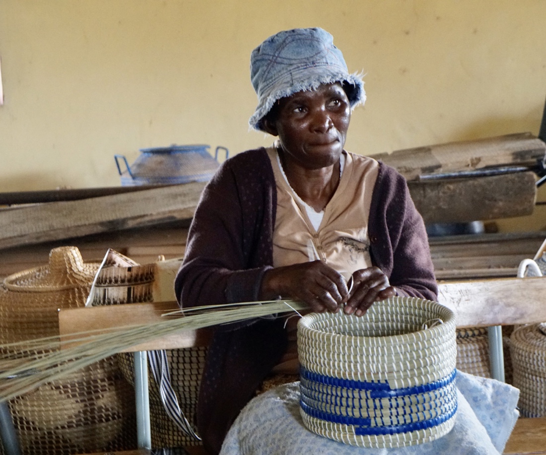  
We next went to see Sibusiso, the airplane guy, a fellow who crafted a home that looks like an airplane out of used parts of airplanes and other metal works. 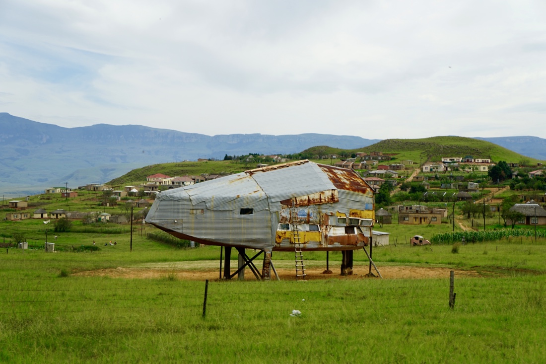 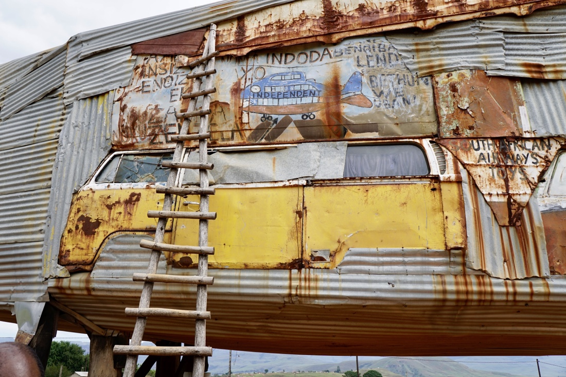 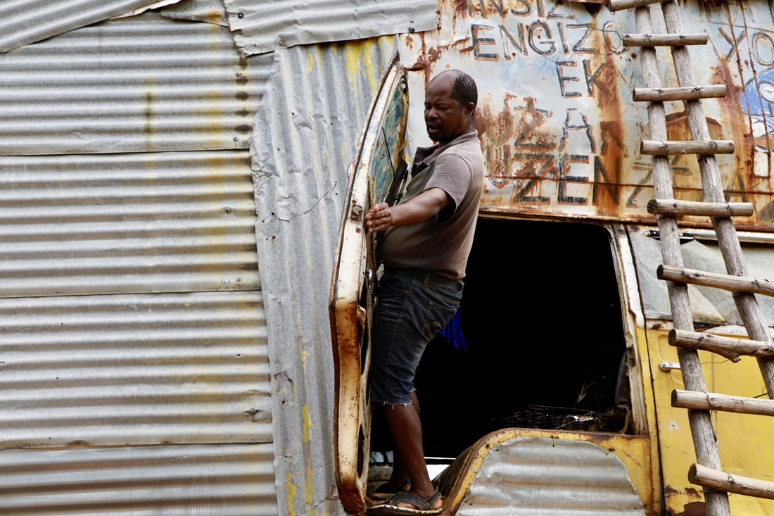 He put it all together with wires, without using welding. This was highly unusual and particularly fascinated Stan, from our group, who has actually built his own airplane. He put it all together with wires, without using welding. This was highly unusual and particularly fascinated Stan, from our group, who has actually built his own airplane. 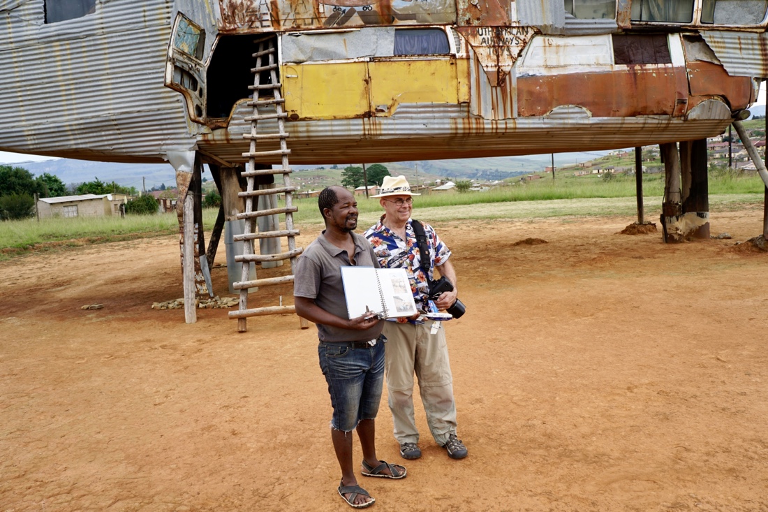 We talked with the airplane guy for some time and saw photos of all seven planes he has built. Most of the group climbed the ladder up to the airplane/house. I told the Group that I did not want to die falling out of an airplane, so I passed on seeing the quarters. This was a fun stop, probably worth 15 minutes, rather than the hour or so we spent there, though our photography group was certainly engaged. We talked with the airplane guy for some time and saw photos of all seven planes he has built. Most of the group climbed the ladder up to the airplane/house. I told the Group that I did not want to die falling out of an airplane, so I passed on seeing the quarters. This was a fun stop, probably worth 15 minutes, rather than the hour or so we spent there, though our photography group was certainly engaged.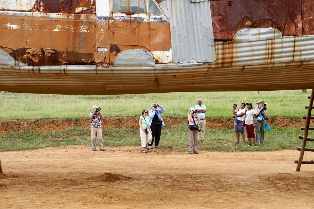
From there we moved on to visit a sangoma, a spiritual healer. She was quite engaging and entertaining, with a marvelous smile.  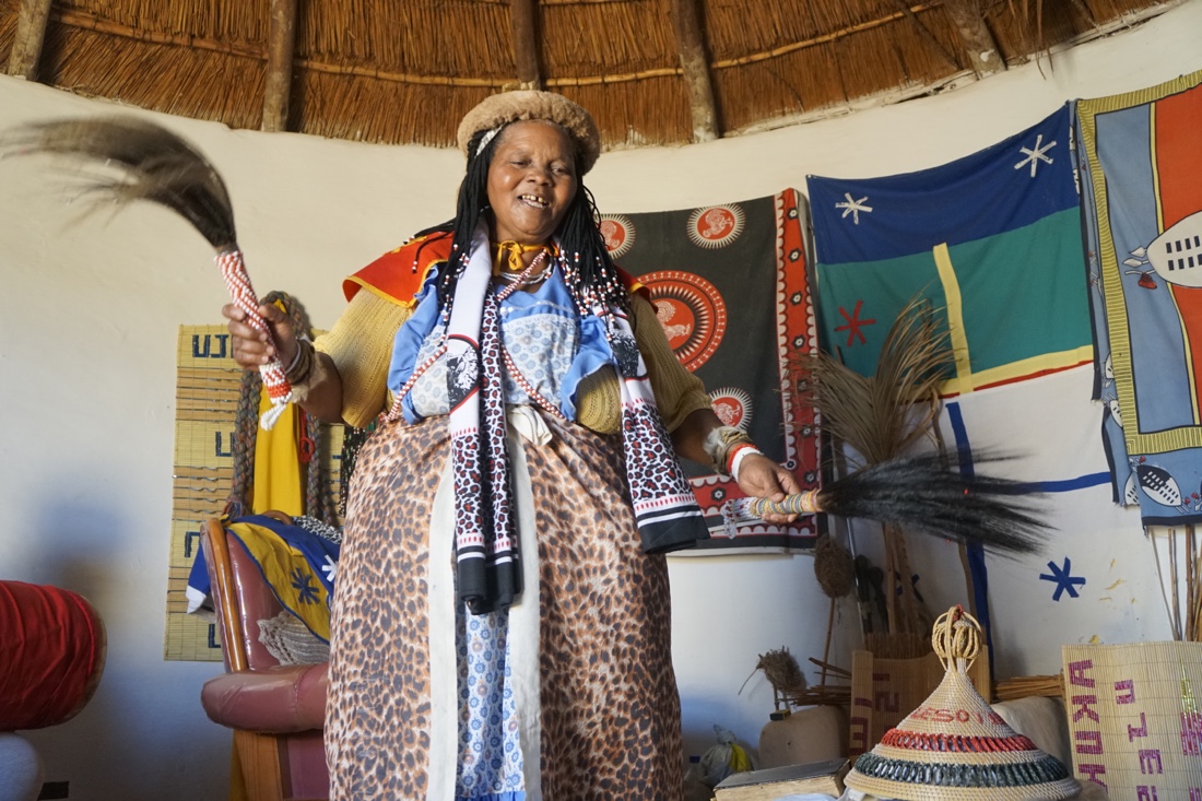 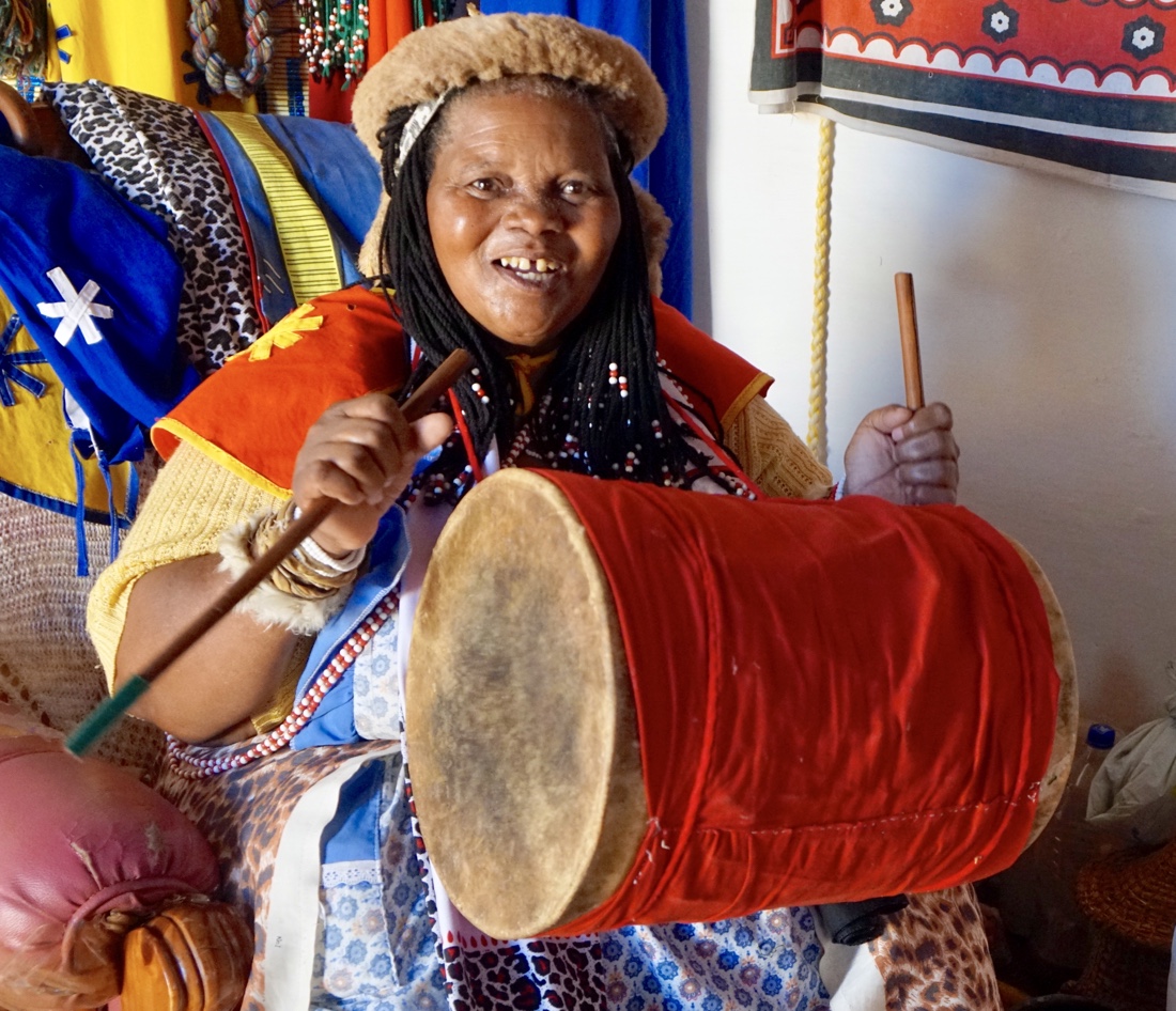 The group was not overly impressed with her healing powers however since what she “saw” (divined) in the couple people who she spoke to were things like sore backs. The group was not overly impressed with her healing powers however since what she “saw” (divined) in the couple people who she spoke to were things like sore backs. 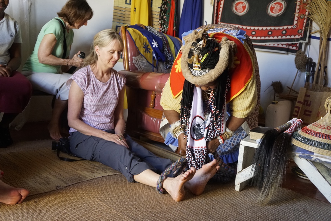 She told a long story about how she became a healer and how it had to do with the surprising death of goats and the appearance of a spirit of her grandfather. We will see other healers on this trip who I expect will ring with greater authenticity, but this visit was fun and afforded the opportunity for some good picture taking. She told a long story about how she became a healer and how it had to do with the surprising death of goats and the appearance of a spirit of her grandfather. We will see other healers on this trip who I expect will ring with greater authenticity, but this visit was fun and afforded the opportunity for some good picture taking.
We ate lunch at the house of one of the locals and then headed to a park where there is a cave with Bushman paintings. On the way, we stopped to see pensioners and others who have been waiting since seven in the morning to receive payments from the government, which might or might not ever show up that day.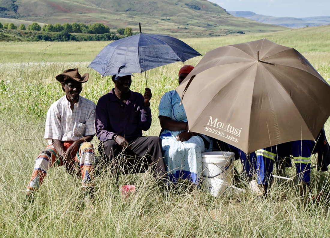  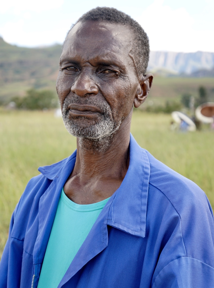
Continuing, through the incredible landscape that covers the whole Tegula Falls area, 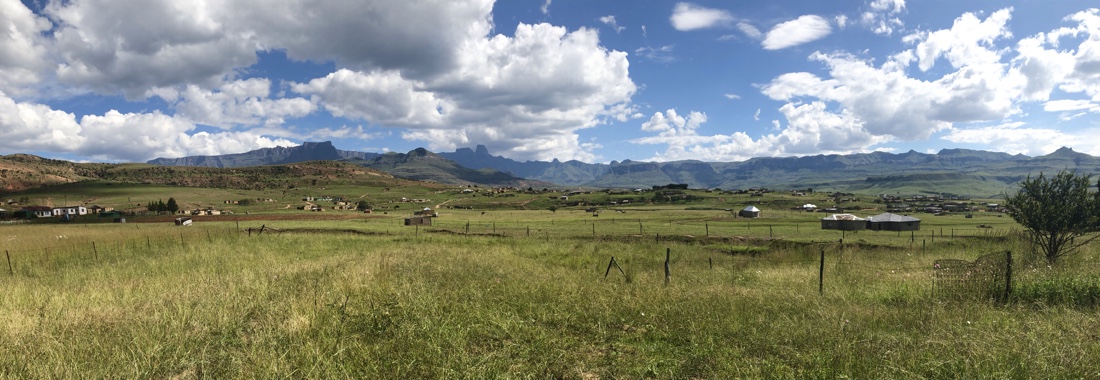 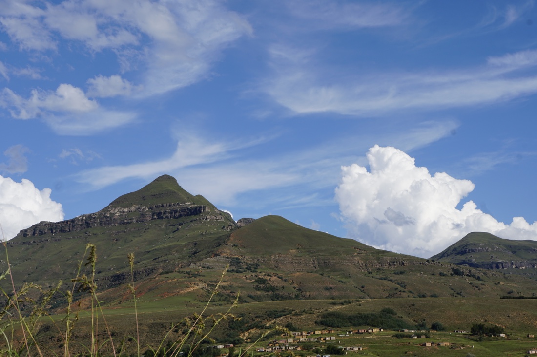
we arrived at the path up to the tetraglyphs. After part of the climb, I decided that I had done enough climbing and so the rest of the group went on and I met them back at the bottom. I don’t regret that decision. Here’s a picture that Nevada took with her iPhone and Air Dropped to me.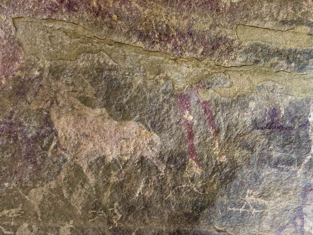
Drinks in the hotel lounge area, then dinner (a much-improved buffet), ending with a cake that Nevada had the hotel bake for Clyde’s birthday.
March 31
After breakfast, we leave at 8AM to drive (216 miles and approximately 4 hours) to Tugela Falls in the northern Drakensberg Mountains, arriving in Tugela Falls after lunch. Roads are perfect and views lovely. We stop at two roadside service areas, both of which surpass US service areas in choice, cleanliness and appeal. Our guide, Ndoda, gives us historical, archeological, cultural and political information along the way. He’s very informative,and the excellent sound system in the van makes it easy to understand him. This afternoon we transfer fro our compact, but comfortable, van to a tractor trailer to be transported partly uphill.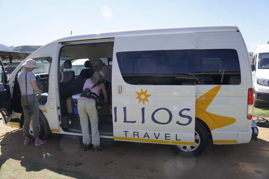  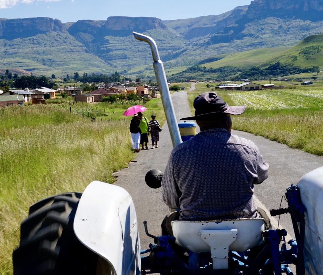
From there we are told that we have a short walk to where we will meet some dancers. This is a lie. It’s not short, it’s rather steeply uphill on rocky terrain. We were not adequately warned about this hike and, as a result, I don’t have proper shoes on (not that that would have made it a piece of cake). I would not have made it except for Ndado’s help.
At the top we see very energetic dances by eleven young Zulu women, ages 21 to 44, against a beautiful mountain backdrop. Here are a few of the several hundred photos I took, to give you an idea of what we saw. The first is our photo group in position to capture the dances. I’ve also tried (unsuccessfully, so far) a slo-mo video done by one of my fellow photographers, Stan Begley.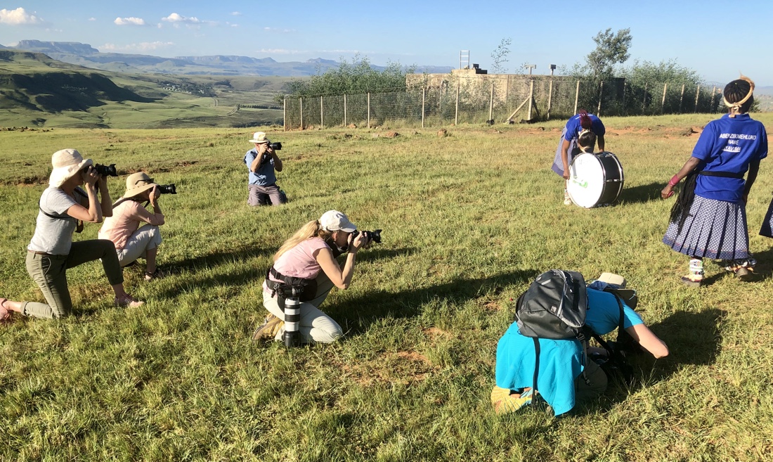 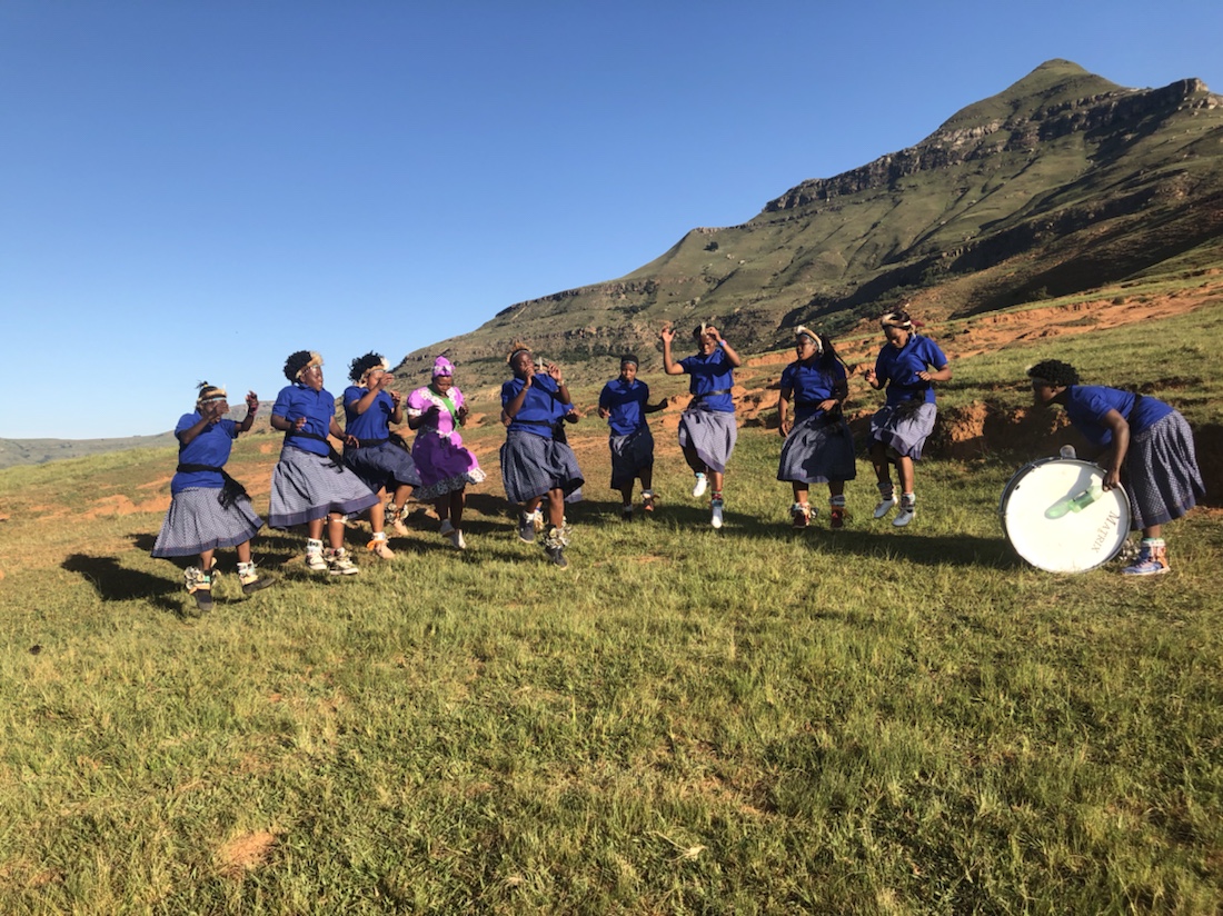
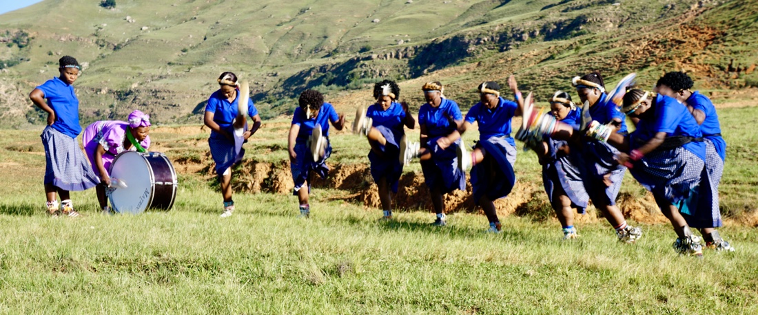 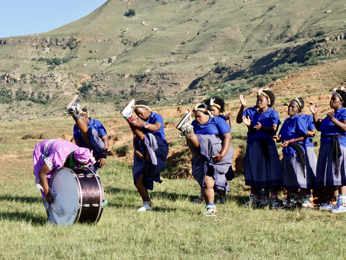   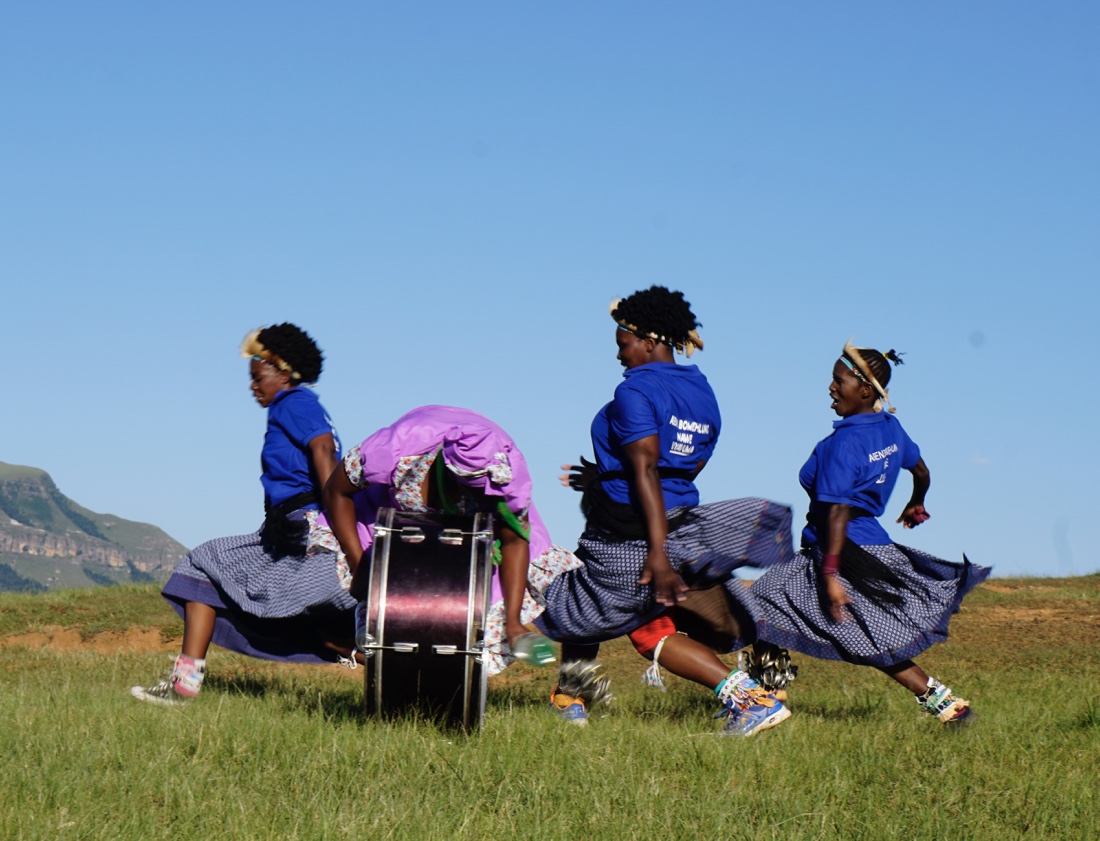 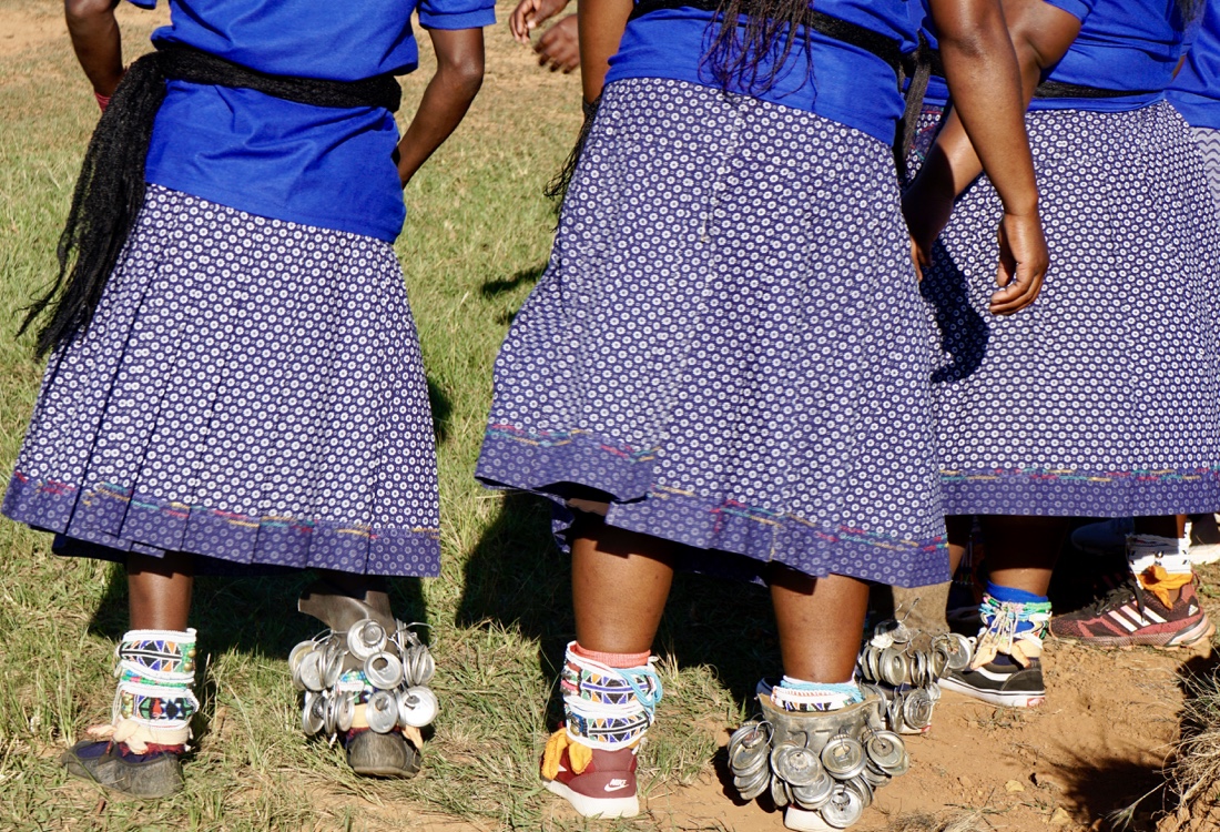 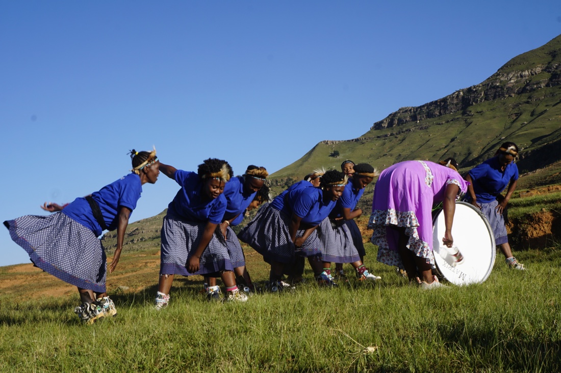 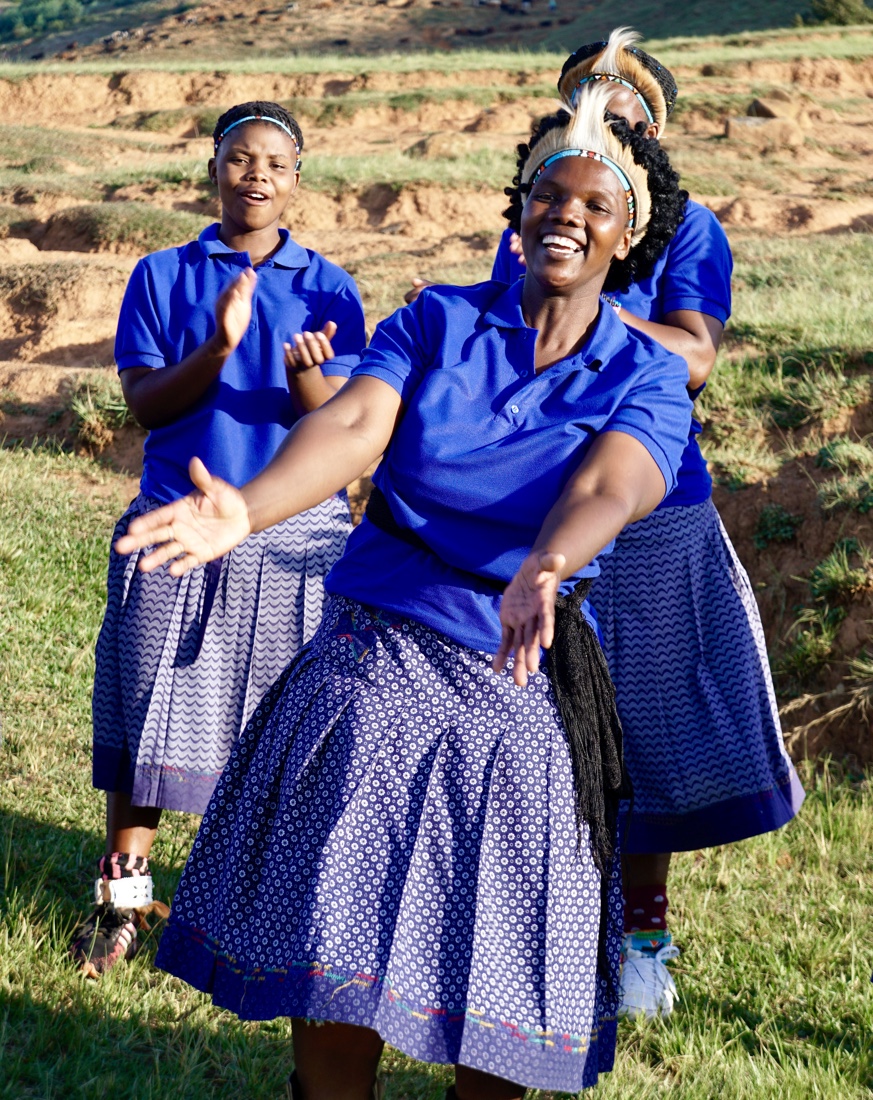 http://dualartspress.com/wp-content/uploads/2019/04/medium-1.movAfter the dancing we take a less steep downhill route. Again I’m helped by Ndoda, who is an impressive and delightfulfellow, raised with wonderful values. Time spent with Ndoda is a very pleasurable addition to,what was planned for the day, an unexpected treat. http://dualartspress.com/wp-content/uploads/2019/04/medium-1.movAfter the dancing we take a less steep downhill route. Again I’m helped by Ndoda, who is an impressive and delightfulfellow, raised with wonderful values. Time spent with Ndoda is a very pleasurable addition to,what was planned for the day, an unexpected treat.
Against a backdrop of untainted skies, green and brown-hued mountains are met at the foot by extensive farms and grazing animals. Crystal clear lakes throw back a reflection of both mountain and sky, picture-postcard in their beauty. Bright, warm days, can be shattered by the sudden onset of afternoon storms, which clear rapidly becoming cloudless, starry nights. Extending up from the Eastern Cape, the imposing uKhahlamba Drakensberg Mountains form a natural border between Lesotho and the Free State. Dubbed the “Barrier of Spears” for its impenetrability, the Drakensberg is a World Heritage Site broken into north, south and central regions. Each region possesses its own distinctive rock formations and impressive vistas. The Drakensberg mountain range stretches more than 620 miles in extent, and at its peak, commands an altitude of close to 11,483 feet above the sea to the east and south.
We are driven to our hotel, the Orion, where we have a buffet dinner that is fair. But the beer is cold, which is the important thing. Room is more than adequate, large and decently appointed.
March 30
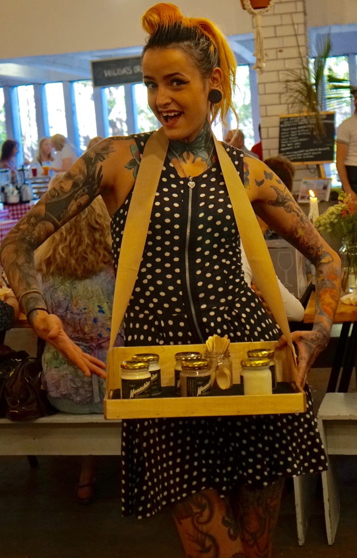
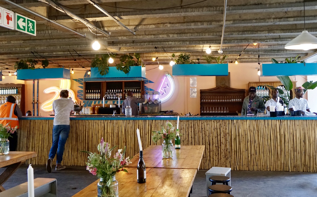
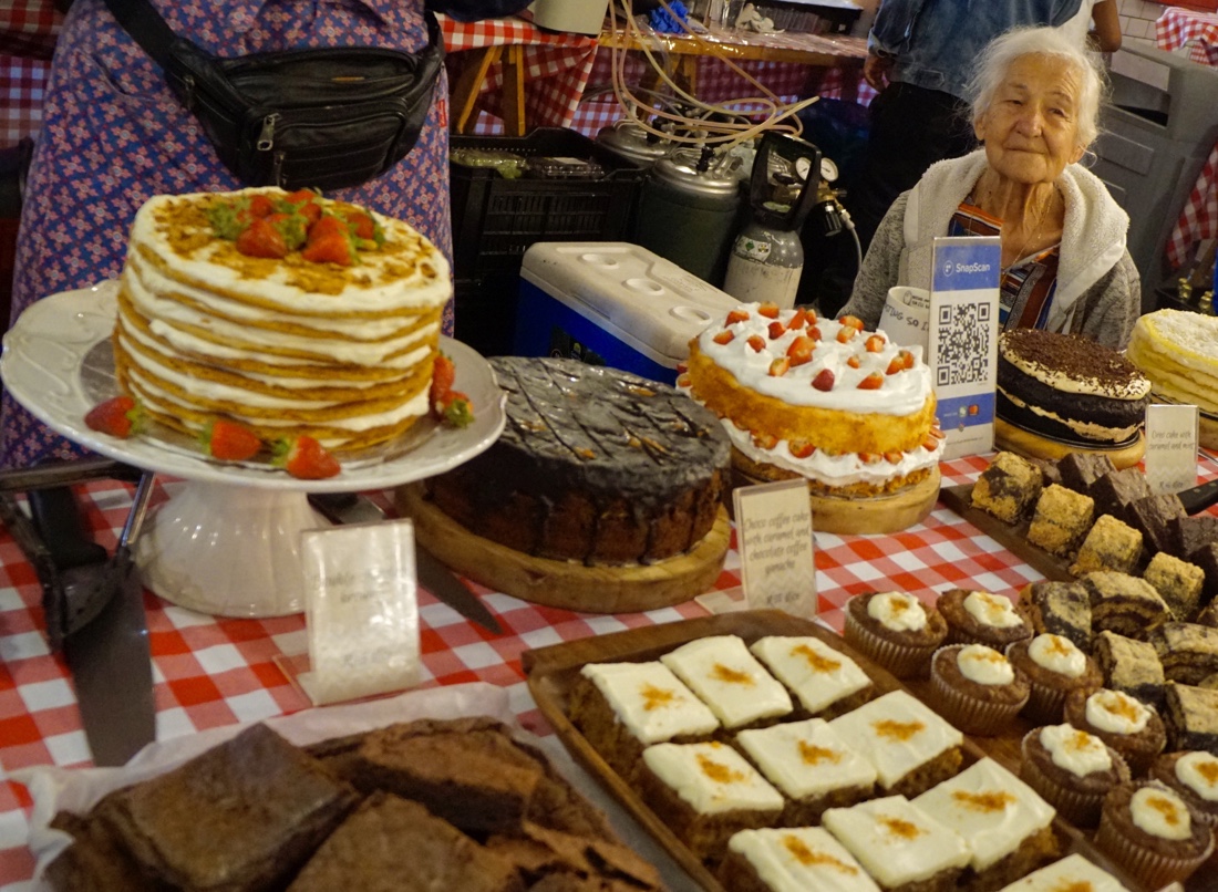
Freedom picks me up after breakfast and we meet Angus to explore the revitalized areas of downtown Joburg. We start our urban exploration in Braamfontein, where on Saturdays a parking garage is transformed into a happening area of food, music and boutiques, which attracts crowds to the area.
After exploring and tasting, we walk around the area and notice some colored lights in the basement of a hotel. We a walk down and are welcomed in to the rehearsal of a rock group from a church. We are brought chairs and we listen in for some time to the rehearsal, which is great fun, and rather good.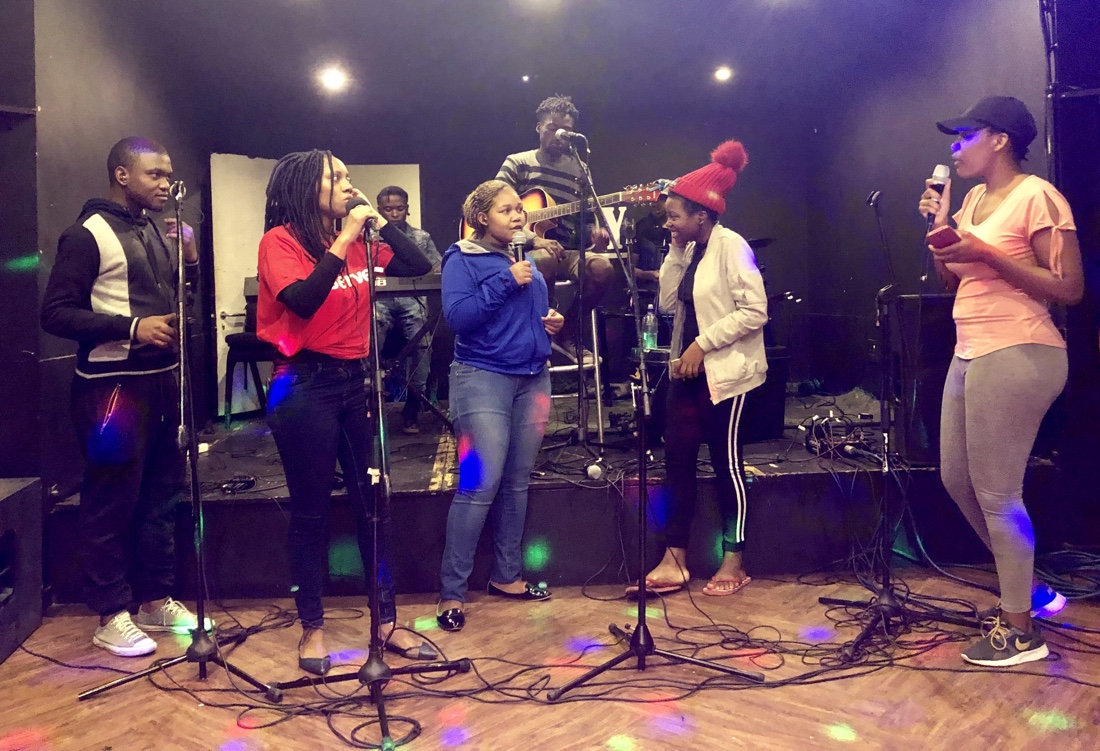 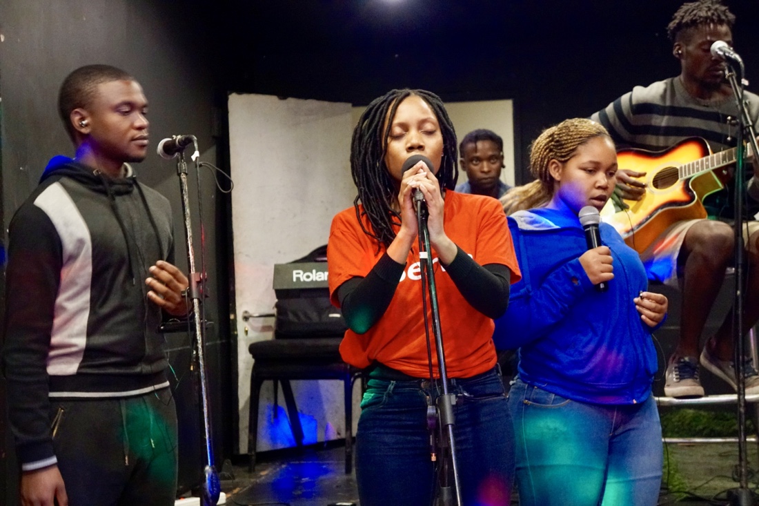
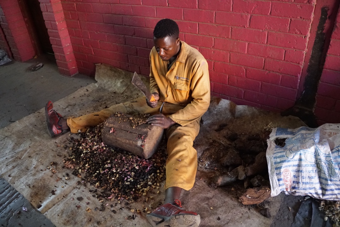
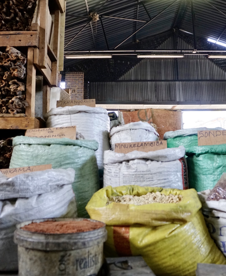
From there, we drive to the Faraday Muthi Market, a fascinating area of people selling all kinds of animal parts, herbs and god knows what else to traditional healers. This is not a place for tourists and Freedom warns that they are very serious about not wanting photos. Angus and I sneak some photos, but are caught at it. They make Angus delete his photos from his phone, but, for some reason or another (I think Freedom’s sweet talking), they don’t bother me. The principal reason that they are so adamant about no photography is that some of the animal parts being sold are from protected species, and if it were known that they were killing and using them, they would be in deep trouble. Here are some of the photos that almost landed me in shaman prison (not really).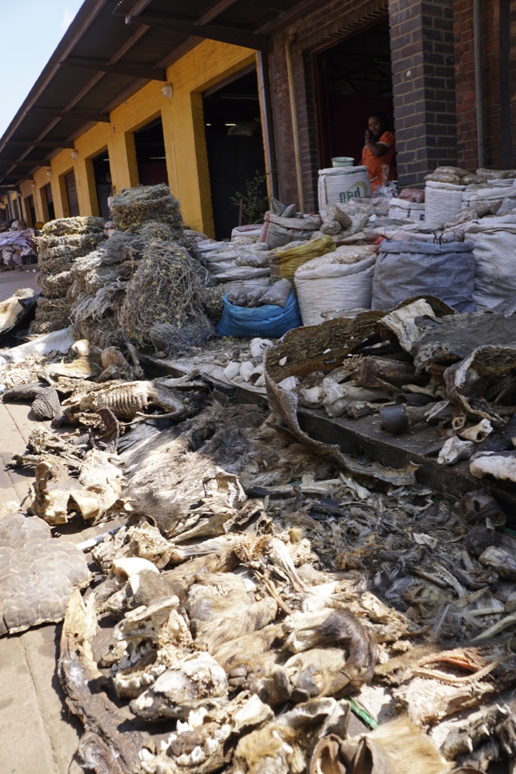 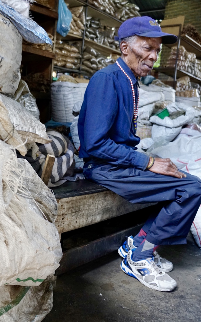
  After this market we drive to see Maboneng, an example of efforts to revitalize modern, inner-city Joburg. Angus was producing radio stories on inner-city revivals in 1994 – it’s been a long time coming. Maboneng is for the trendy and adventurous traveler alike. Loaded with boutiques, restaurants, t-shirt sellers and the like, it feels (and is) very commercial, but also very successful. After this market we drive to see Maboneng, an example of efforts to revitalize modern, inner-city Joburg. Angus was producing radio stories on inner-city revivals in 1994 – it’s been a long time coming. Maboneng is for the trendy and adventurous traveler alike. Loaded with boutiques, restaurants, t-shirt sellers and the like, it feels (and is) very commercial, but also very successful.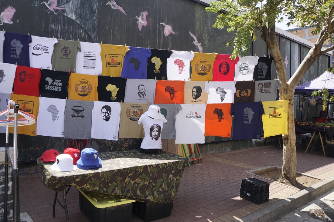
After this, Freedom drives me to the Kim Sacks Gallery. Kim is a longtime friend of my travel agents, Jean and Ahdina Zunkel, who urged me to try to stop by. My quick stop by turned into two hours, largely spent in conversation with Kim over tea. Her gallery is terrific, a blend of modern and old. Kim is an accomplished ceramicist and still teaches ceramics two days a week. She’s traveled widely to see and explore ceramics, ancient and new, in countries around the world. She’s something of a character, so talking with her was a treat. If you’re going to be in Joburg, go have tea with Kim, kim@kimsacks.com. If you want to look at her website, it’s www.kimsacks.com. I can’t say whether I bought anything, because Carol is reading this blog.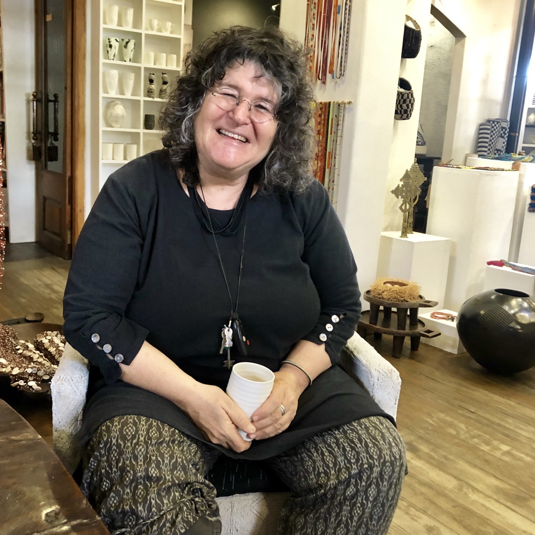 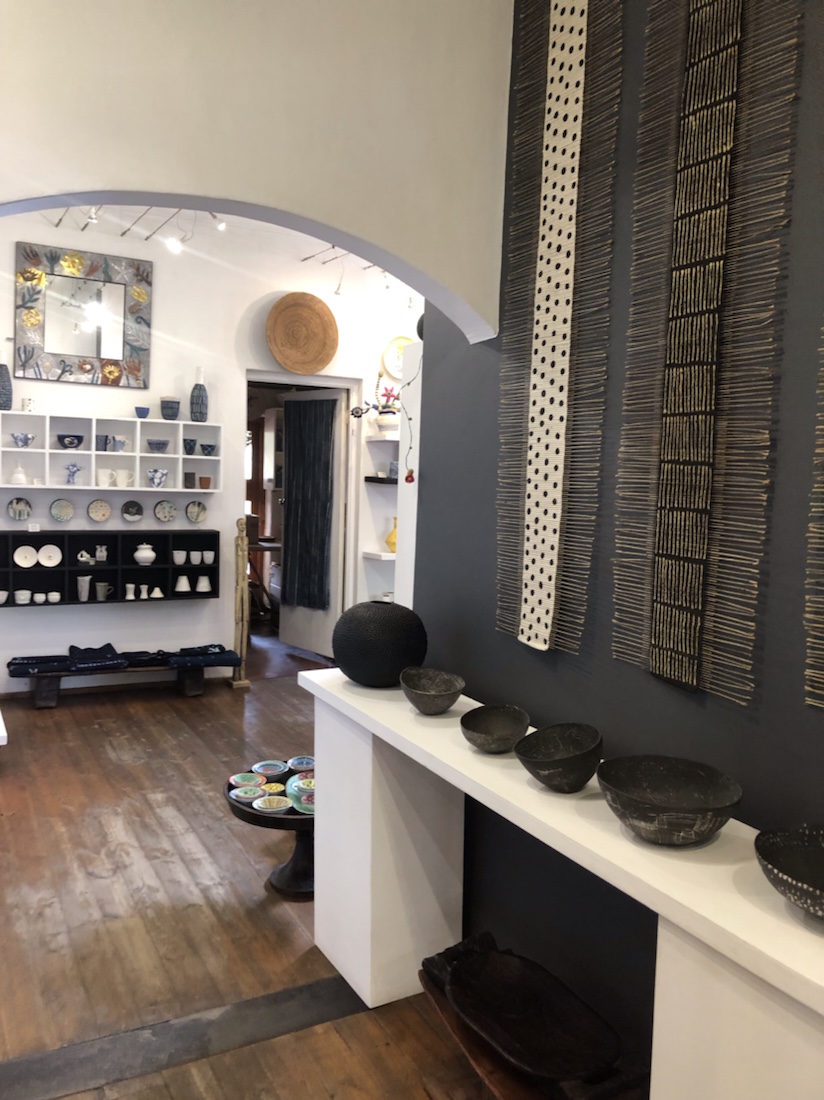 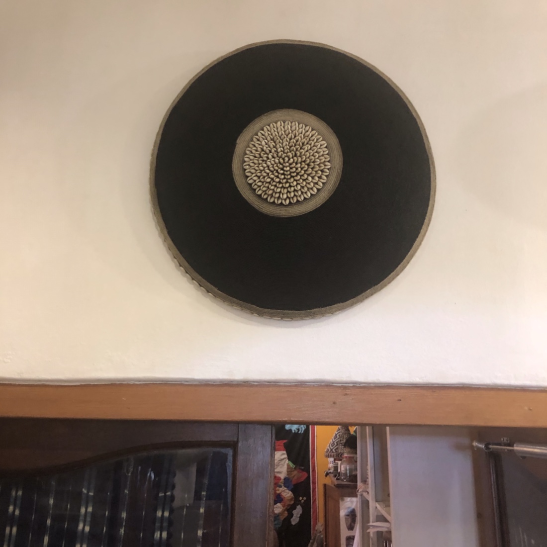
Freedom then drove me to Hallmark House, where I am meeting the photography group for orientation, drinks and dinner tonight.
Seems like a good, congenial group. Seven of us. I went to Colombia with Stan, one of the group. Nevada is a terrific leader and our South African guide Ndado seems good.
Out to dinner at a large, okay restaurant in Nelson Mandela Square. Below are photos of the statue of Mandela with the Hard Rock Cafe sign in the background, and of children playing in the fountain between the statue and the cafe.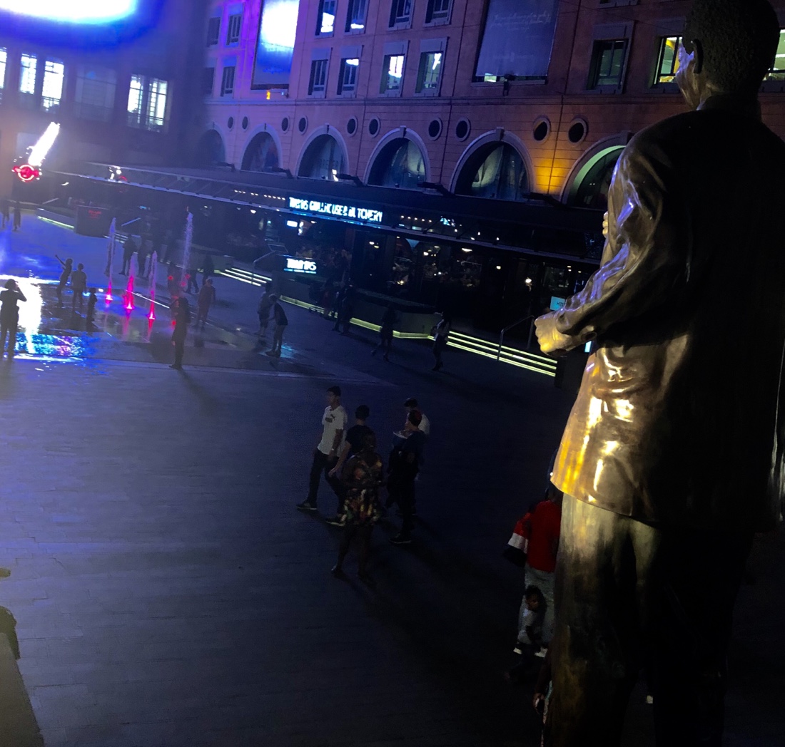 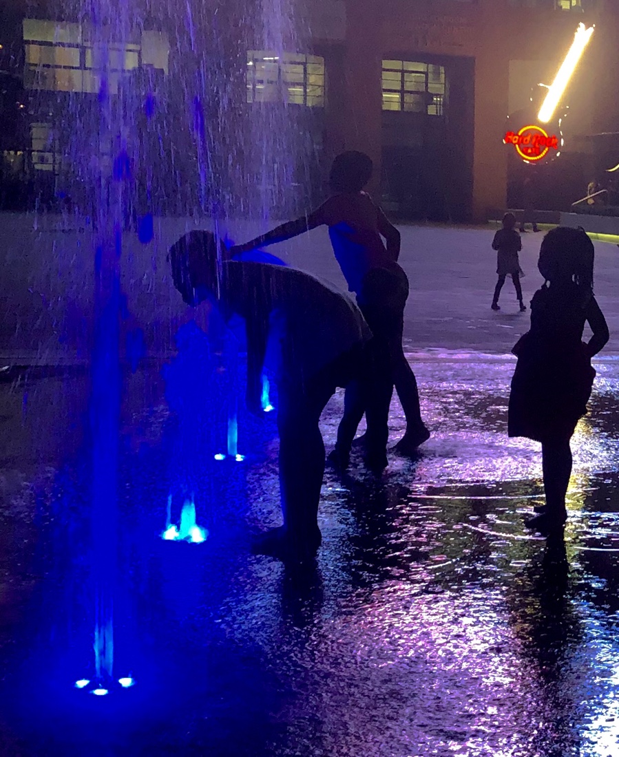
Return to the hotel to retire.
|
|